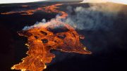
Natural-color Landsat 9 satellite image captured on December 2, 2022, of the ongoing eruption at Mauna Loa. (Click image for wider, high-resolution view.)
The Landsat 9 satellite acquired this image of the volcanic eruption as lava flowed past the Mauna Loa Observatory toward Saddle Road.
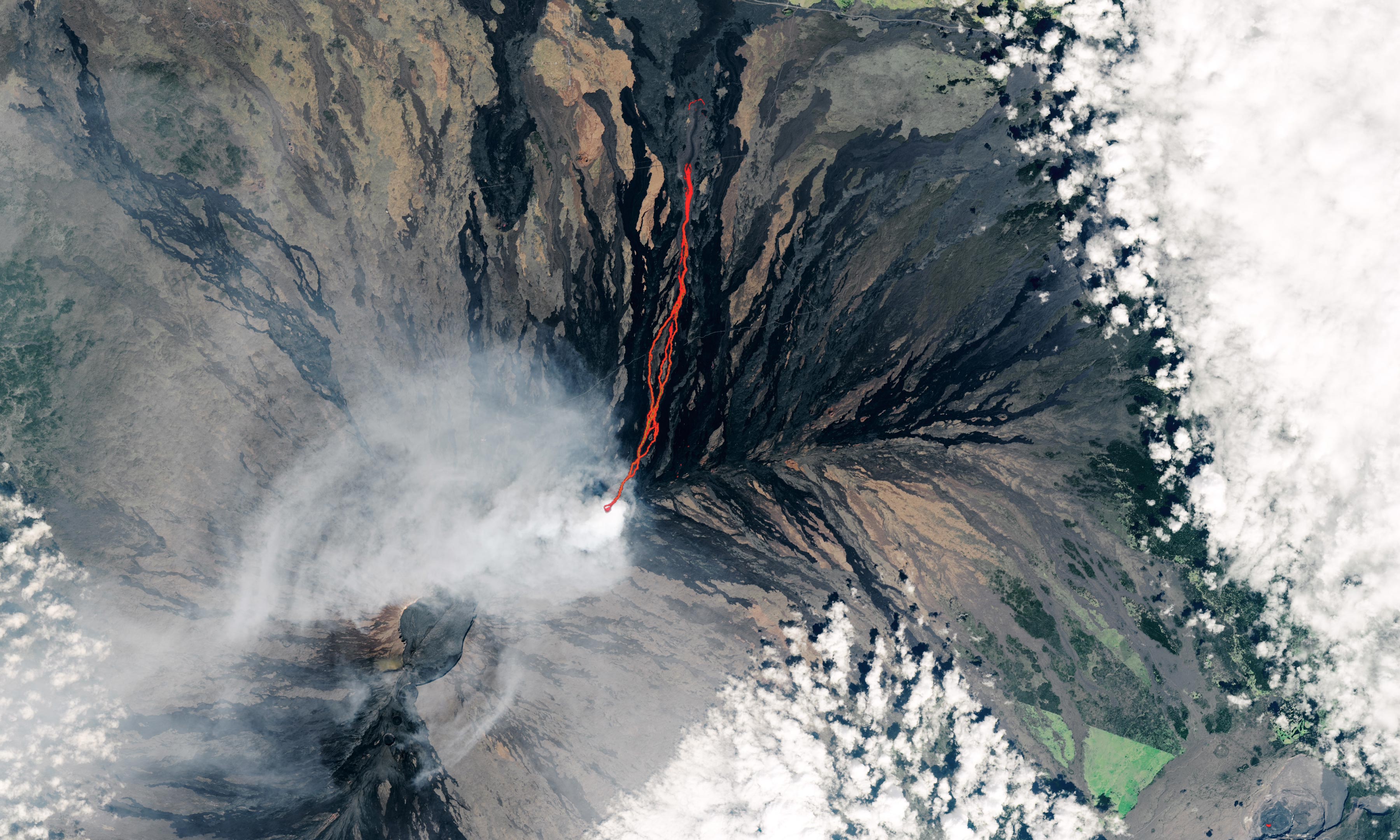
On December 2, 2022, this natural-color satellite image of an ongoing eruption at Mauna Loa was acquired by the Operational Land Imager-2 (OLI-2) on Landsat 9. At the time, lava from the Hawaiian volcano was moving north toward the Daniel K. Inouye Highway (Saddle Road). The image is overlaid with infrared data from OLI-2 showing the location of warm areas associated with lava.
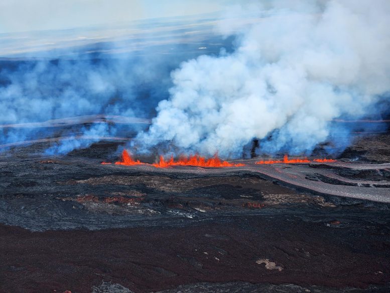
Lava fountains along a fissure on Mauna Loa’s Northeast Rift Zone at approximately 9:30 a.m. HST on November 28, 2022. The photo was taken looking toward the north. Credit: USGS photo by K. Lynn.
NASA Earth Observatory image by Lauren Dauphin, using Landsat data from the U.S. Geological Survey.


I don’t know who labeled that photo, but the Mauna Loa Observatory Road label is pointing to the wrong road (source: I used to work at MLO, so I’m pretty familiar with the road). The correct road is parallel to the one indicated, but higher up the slope (lower in the photo) leading directly to MLO.